

geoFlier
An application designed to geolocate the activities of advertising material distributors.
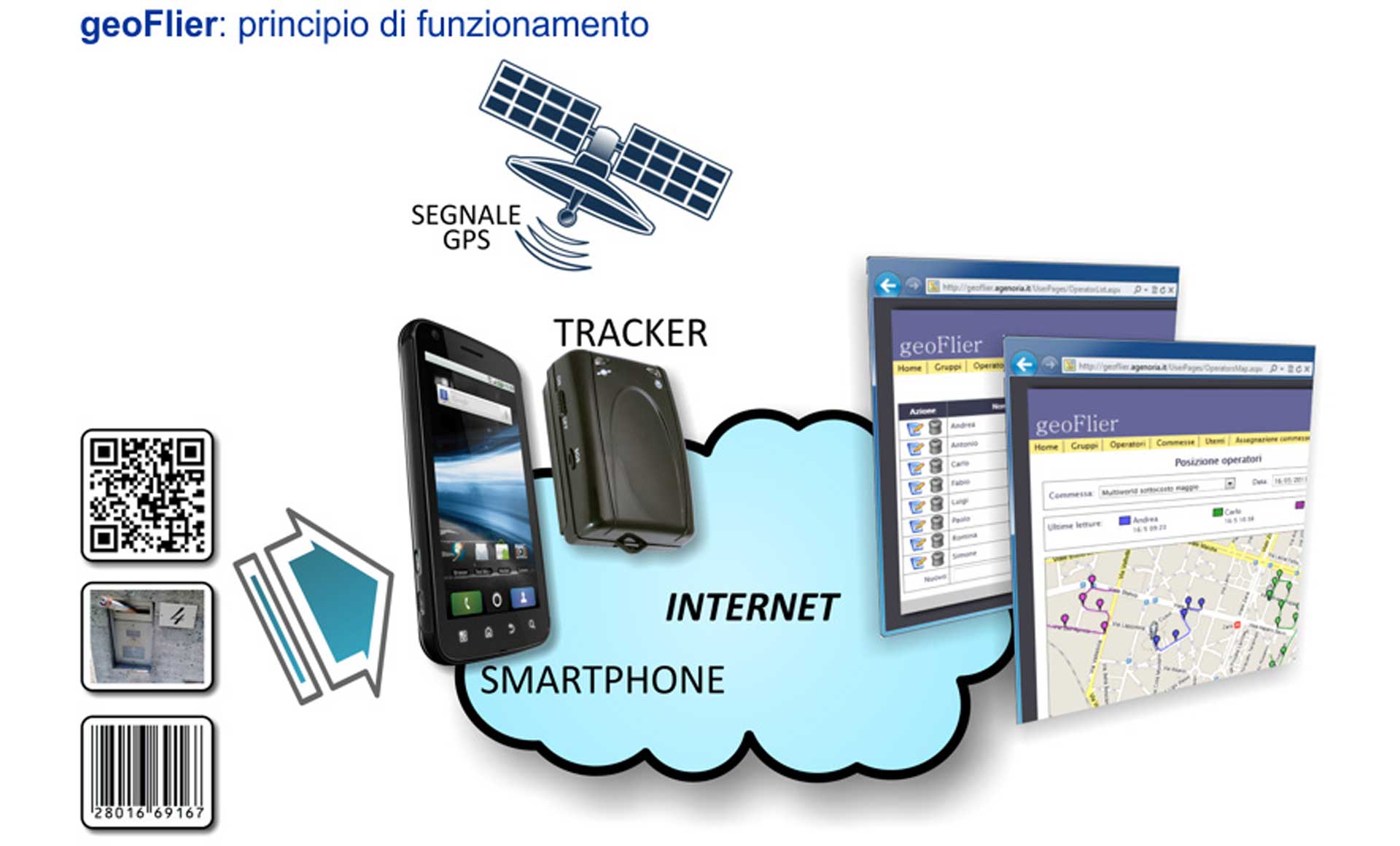
geoFlier (or GeoFlyer) is an application designed to geolocate the activities of flyer distribution staff. Thanks to its efficient architecture, geoFlier enables real-time tracking and map visualization of the area covered during flyer delivery.
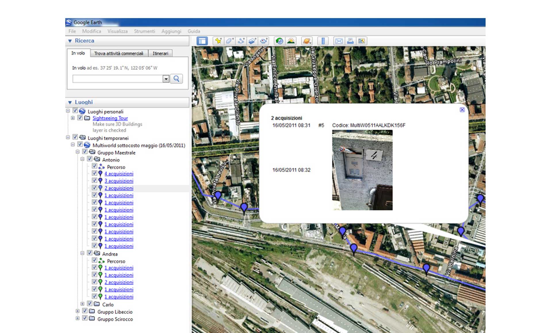
geoFlier utilizes widely available, mass-market geolocation hardware, ensuring low device costs. By using smartphones, geoFlier enables GPS-based location tagging for QR codes, barcodes, and photographs captured during distribution; the collected data and location information are instantly transmitted to the web application used to gather data and track the activities of the distribution team.
Technical sheets:
- Agent registration;
- geoFlier allows the application administrator to view every tracked route and the associated data collected; it is also designed to enable clients to access the information gathered for them;
- geoFlier (or GeoFlyer) is highly customizable for use across a wide range of sectors, such as logistics, security, transport, distribution, and industrial support;
- The project name is geoFlier, but to align with the common usage of the word "Flyer" (derived from the English verb "to fly"), we also use the spelling GeoFlyer (with a "Y").

×